
Impact Craters of Alabama, USA
Step 1. Established by literature - Wetumpka


2. Geology Anomaly Map - These maps can vary so as a tool set you have to know that.


Shown above is a Central Alabama Impactite. It has liner constellationing and is shock melted breccia.

Dale County Impact Diamond!
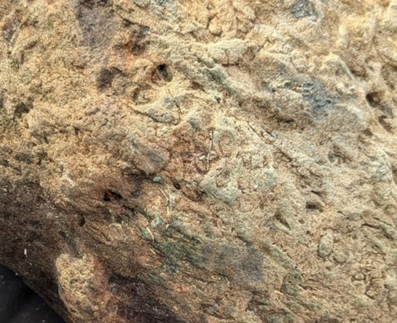
Jasper Crater


The many crater coal circles of the United States. The organic material is heated and compressed by the impact event. This can result in a charcoal shale, oil shale, coal, oil or even diamond. Somewhere near the crossing of the lower circles in Alabama a diamond was found.

Georgia map to see the border crater better.
3. Strata out of place - Well here we go again with the circle hunt.


The strange round impactite of Wilcox County, AL
The Big Cambrian or Pre Cambrian Guntersville, AL centered impact. It set the contour for the rest of the subsequent strata to follow but the tectonic push that makes the Smoky Mountains is over it and has broken it which is why gold is exposed. This impacting bolide carried it to earth. This is a retarc crater an outie type caused by lower explosion.

Wilcox County is the ending crater part of the really big multi state impact. Jan. 20, 2025.
Wilcox County, Alabama Impact shown in lower left on map. Specimen above is impact breccia with dark matrix from impact.
So why did Birmingham, AL have all that iron that was mined there? An earth hole punching impact is why. Crusta Confractus. The extent it has less earthquakes today is healing. Is still doing that and is why there is a circular area with earthquakes. Earth is the only self healing planet. The iron recovered was the easy exposure from the tectonic fold. Mush more iron is under the area of the earth breaking impact.

Crusta Confractus>
Crusta Confractus>
Crusta Confractus>
Now notice how the presence of gold corresponds to the earth crust breaking impacts. But the gold comes from the impacting bolide.

.jpg)
Circular Karst Shadow from big ancient impact. Predates the Smoky Mountains.

And sure nuff, here it is, the undefined contact and unconformities in the e Cambrian and pre Cambrian. This is from the online lecture notes for University of Alabama geology course. https://www.southalabama.edu/geology/haywick/GY112/112lect29.pdf
So as a tool user, I suspect the Alabama anomaly map is not the best nor is their strata map. The way the south works is you have Mississippi so you compare your state and show how much better you are. Mississippi does not even have a geology anomaly map.
4. Presence of impactites - This is an impactite. Alabama creek - Provenance. Iron, cobalt, quartz from my crater, therefore source and agency. If it were found in a cave it would have the provenance, source agency. Found near a metal furnace, same. But you so often see post of rocks found just out in the general environment. With a million earth surface impacts based on Mars, I usually favor impact.


Shown below is a fast formed crystal dug up in a yard near Montgomery, AL. Shock resonance forms these structures. It is a harmonic with multi frequency so crystals are often twinned and of "finding form" shapes. It also received the iron mist from the meteor vaporization. Overall it is trying to second iterate fractal by branching but is not a pure harmonic.

Patrick hyche found this specimen in central Alabama. it has the mini impact spheroids. the blue may be a copper allow. the impact storm has made the small white particles that are forming web structures from the heat. The baby blue color could be this impact metamorphic NaCu2Si3O8(OH)


Here is the angular sandstone metal crossbedding in Alabama again. This section is 25 miles NE of Wheeler Dam on the uppermost TVA impounded flood plane. It has nano cobalt and iron. A frozen moment of solidification post impact from the Frankewing, TN Impact.

<<<< This is an event that occurred in minutes not geologic time with an unknown gap or disconnect.
Now this chart is the textbook geology upper geological column for Alabama. It has the same fundamental problems as those for Tennessee or anywhere you may encounter these. First of all the idea of a sameness of strata that stretches across the world, country or state is just not plausible. That concept implies the earth, country or state to be laminar sheets. I jokingly call it the flat earth theory. The earth is and has been varied in terrain by locations that even are being changed by "sudden impact." Different terrain in just minutes. Could be vast areas. And even when you study some of the mapping like this chart it has recorded these impact as unconformities which are the striped line area. But you can see the unconformity varies through the conformities? A state column does not exist as that is too broad an area but gets a smoothing brush as what might be found in a chart. The unconformity between the Ft. Payne chert and the Chattanooga shale is on to something, but confused. The Frankewing TN Impact made the Ft. Payne chert and the Chattanooga shale over it's vast area but that is only the top of Alabama. The same is true for the other listed unconformities. They are local to some area but not the entire state. Even the really big Guntersville Impact shown above does not cover the lower state.
Dismals Canyon

Sandstone deep crevasses. Forget deep time let's talk about deep crevasses. I have found these before in Marshal County, TN. They were from the blast wave of the initial impact of the Frankewing, TN Impact Structure. Even though Phil Campbell, AL is so far away the deep crevasses in TN were cut out of limestone and this is just sandstone. Also I have found sandstone ledges made from the Frankewing, TN Impact into Limestone County, AL. The geology timetable also fits. Now look at the cliff below and notice the micro mineral coloration. Micro minerals fall from the vaporization center and reach out long distances.
.jpg)

Hits Western Highland Rim and dumps iron.


Western TN Crater Unknow Age.
The NW Alabama crater is earlier than the Frankewing Impact.
Black WarriorBasin Crater
Impact crater!
Impact crater!

Impact sphere from the Wetumpka Alabama Crater. It has heat mosaic cracking. Specimen collected by Jennifer Collier Simpson

Square compressed expansions of later arriving iron splatter. - This is a rare shock made figure, an expanding bubble being compressed on sides by other bubbles. It is from the Russellville centered crater. Specimen collected by Savannah Whisnant of Gadsden, AL.


Shock made mega clast with splatterform mosaic geometrics. Not a true mosaic but the intense heat seems to have made alterations to these figures. As you can see some of the plate capsules have fell off. During the impact explosion this bolder was launched and landed then received this iron splatter or could have been splattered in flight. The hollow nature of some of the tracks and the quartz inclusion indicate it was a high energy charged splatter. You can even see quartz fractals in these tracks. So why do you see the geometric shapes? Resonate energy does have the power to form shapes according to the wave type and the linear splatter and moving rock will have a dispersion that will make some geometric forms. The physics of a high charged hypervelocity conductor intersecting another object in a super high pressure is not reproducible in a laboratory.
Christy Lyle
Found in bankhead forest Alabama....never seen anything like it....is it fossilized roots?
The surface was very hot and has little round holes from gassing. I think it is a silica olivine pseudo cubic, a shock made peridot olivine. Specimen collected by Michael Ray in Blount County, AL.

Impactite doughnut. Was it impaled? Appears to be the case. Found by Mickey Brown in North Alabama.


This is an impact plasma form with inclusions and harmonic signatures. Josuah Ridge of Red Bay, Alabama. It also has impact sphere catcher signatures.


My new area of research. I believe this to be a crater wall pushed up from a sea with impact center at Hollywood, AL. The sandstone contains the once liquid iron from the meteor bolide. Location is Cooper Top 1,800 ft. elevation, Franklin County, TN. The earthquake record is the crust still resolving this stress. Notice the crater type unconformity along the top making a ledge.

Soils and sand vary around the globe as they should being an impact product, specific to the impacts. The later craters excavate. So what I have here at the top of a crater wall mountain is a push up of 1,800 feet of sand a pulverized product of even larger earth impact. There were many. Mars has 640,000 craters! It also has a soil. The sand maker for this material could be any of a number of SE USA impacts. The craters overlay. My guess was the sand was made pre Silurian. There is a very old crater under the Smoky Mountains west side of North Carolina which is Ordovician. This new crater is entangled with the concentric crater rings of the Silurian Extinction Event crater centered at New Madrid and making the Smoky Mt wall. It is outside of the Middle TN Basin buster that made the Highland Rims. As it is smaller than those really big craters I am going to statistically put it in the Devonian. The Tennessee River has cut through the crater making Sand Mountain on one side and the more natural sand crater wall on the North side. It must have been a partial sea. The shape of Sand Mt. resembles a flow made structure.

Melt composite cone, rare. Impactite. Explosion matrix. High diversity of minerals, inclusions etc is a hallmark of impact made rocks and strata. High heat is another. To melt all these different minerals you have to exceed the melting points of the higher melt temp. minerals which is actually higher than volcanic temperatures. I hope you don't mind but I need to add this specimen to my Alabama and Shatter cone pages. It is not a shatter cone it is a melt cone but I group by shape.
Kim Wright
Found this in Walker County Alabama. I don't exactly know what it is but it kinda looked like a foot all together with 3 toes.


Stars fell over Alabama and you have found one. Weathered, ablated, meteorite sphere. A silica iron, while the iron content is low NASA proved back in the 1960's that shock can realign iron to produce a non magnetic iron. This specimen has been cavitated and pieces have broken off from being carbonized during earth entry (4,500 degrees F). It is a priceless find.
So was it a sphere before earth entry or was it ablated into one? The duration of earth entry is marginal for sphere making.
Norm Holth · ·Oct. 8, 2022
This is interesting. It is not magnetic. Any ideas?

Shock made mega clast with directional melt flow and surface mosaic "toenail" delamination from cooling. This will be very heavy. These can be thrown a hundred miles from crater or can be in the center, I live in the large Howell, TN crater and have them in my yard.
Anthony Jarrells · Russellville, AL Oct. 14, 2022
Any idea as to what this might be? I haven't brought it out of the woods yet because I'm gonna need help. Is it worth retrieving?

Shock fossils, that is a shock made granular matrix. Shock metamorphic. The fossils have been instantly replaced with Fe3O4 black iron oxide or Manganese from the bolide vapor blast. An edge effect.
Elizabeth Martin-Webb · Oct. 29, 2022
I found this little beauty in Warrior yesterday

Shock made high heat mosaic, think of it like bread rising. The green is likely moss but the red is nano iron pulverized in the impact as is the blue nano cobalt. In the magnification attached, 1 is mosaic heat delamination. 2. is fractals an energy signature as an impact environment is a high energy event with both shock and electromagnetic energy. Iron and cobalt are magnetic. 3. shows the shock particles in configuration called "Constellationing." Is like the fractals on surface making connected forms. Also under magnification it appears to have small sphere impalements from the impact event. Your specimen is an impactite from the "Jasper Crater." The Jasper Crater is a type 3 exploding impact of 100 to 200 miles diameter, post Ordovician is likely from the unconformity record. Unconformities are wiping events caused by impacts.
Kim Wright · Jan. 1, 2023 ·
Found at old coal mine in Walker County Alabama. There were several of them in an area. They were in a "tracks" pattern.

The Jackson County Crater and the Huntsville Crater. Both craters lost significant material in the later Howell, TN Impact blast. The Jackson County impact is a "retarc" type where the explosion took place deeper and caused an uplift type crater. July 25, 2023.

The Huntsville, AL Impact Crater, Part 1: Sun cresting the crater wall as seen from the Space and Rocket Center. July 23, 2023. (date of picture, published on 25th)

Huntsville Crater also makes a population crater.

Wernher Von Braun home. 1958 Mid-Century Modern. 1516 Big Cove Rd. Huntsville, Alabama. He had the yard paved so as to not do mowing. This was later changed back. It is located on the inner face of the Huntsville Impact Crater east side at Monte Sano. The German Rocket Scientist liked the Monte Sano Mt. location because it reminded them of Germany. July 25, 2023.

Impactite across the street from Wernher Von Braun Home. The holes or vugs are made by plasma iron from the impacting meteor/bolide. The silica has a higher gassing point and is able to retain these impalements. This is the same principle as iron sand casting. July25, 2023.

Impact debris boulder in front of Von Braun home. July 25, 2023.

Dripping viscous boulder one street south of Von Braun home on Mountain View Drive. This street was built in the 60's and 70's with more mid-century moderns. July 25, 2023.

Trailing cavitation, front yard on Mountain View Drive. This is how you orient the blast direction and confirm your crater. As you can see the blast is coming from the right (west) which is the crater center. July 25, 2023.

Space walk on Mountain View Drive. What does it mean? July 25, 2023.


The Castle Rock Crevasse. This feature is located along the road at the spot shown above on the map. It is a blast crevasse made when the explosion ripped through the existing landforms. On a crater wall it is difficult to tell what gets pushed up there and what was there but the overall pattern to the blast crevasses align to the center of the crater although at differing angles, some low and some high. This means that the blast pushes up a crater while sculpturing it.

Crater Cross Bedding - Shown left is the blast wave groves with a change of angle like the blast crevasses also do. The crevasses in the front boulder are lined up with this blast angle. This is a macro cross planar effect. July 26, 2023.

Melt blast wave. This mountain boulder was once located in the crater floor. It has been excavated to the crater wall in the impact blast process. That process continued to sculpt it directionally complete with drip effects. Monte Sano Mt. Huntsville, AL Crater, Devonian. July 27, 2023.

Jabba the Hutt - Cold Springs Trailhead, Huntsville Land Trust just up the roadside a bit, Monte Sano, Mt. This is called "trailing cavitation." It is a directional indicator with the shock blast coming from the back and to the right. The crack at the bottom of the figure is high heat mosaic cracking. The splatter in that area is a progressive explosion form arriving late in the impact event. The cleavage top and behind is also a high shock directional indicator. The color is called "shock white." Shock white is from the high energy that burns the impurities out and compresses it as a "rarefaction physics" the long wave hits it first and the back side of the wave compresses it. This multi hundred ton boulder is no longer earth strata as it once was. It was tossed up to the crater wall landing on top however heavy. The top boulders on a crater wall were the deeper impact excavated lower crater strata. Historical note: During the NASA moon shot days, Marshall space flight center in Huntsville sent an investigator to solve the Howell, TN Impact Structure in Lincoln, county and he drilled cores but was pulled off before solving the crater. Had this been solved the fact that Huntsville is a crater also would have been possible as the later Howell event wiped the north and west Huntsville Crater wall. Alas you can learn more with a mission to Earth. https://www.hillbillyu.com/background

Dendrite fractals with energy coming from bottom to top. This is a fast form phenomena like lightning. Branching is a function of the energy's power. As it degrades it branches more often and will even shift to balls similar to ball lightning. Oct. 6, 2023.
Baylor Wagnor · ·
Is this a fossil or just an odd pattern? Has similar patterns all over it and on the inside of the rock. Found in Blount County

Impact spheres, Elmore County, AL, the Wetumptka Crater. Sphere on the left had burnt material inside which fell out like dirt. It is an expansion, like a geode. Oct. 25, 2023.
Karen Blackmon Stacey
Top contributor
Lee Isham I agree. These were found in Elmore County Alabama. A meteorite hit here. We think they are part of that. There was red dirt inside.


Picture top is "resonate partitioning." Impact made shock being distributed into matter. It is a progressive event and has a larger linear shock imprint running top to bottom which is dividing the resonance. Picture bottom is energy leakage showing the resonant energy so high it is making fractals outward like lightning, an energy dissipation process. I just moved to Cullman, AL from TN to study the impacts of Alabama. This crater while not centered in Jasper I have named the Jasper Crater. Alabama is a more complex crater canvas than TN. Some of the impacts are so large as to encompass both states. Attached is a dominate crater map. Based on Mars the Earth has over a million craters of one mile diameter or greater so Alabama would have around 2,000 surface craters. Nov. 25, 2023.
Photos from Natural Bridge Alabama
Is the 1st picture the flow of lava running into something and folding over?


Remember making connect the dot pictures? Well, impact craters that are recent make earthquake dots and circles by connecting them. The reason that lower Alabama is so earthquake free is it is not a big previous crater basin which exposes a lower strata that is hard and able to be broken up. Dec. 13, 2023.

Energy Stratigraphy - Crater unconformity not sedimentary physics. Voids and vesicles, another not-physics for sediment. Up thrust plasma, certainly not sedimentary. Volcanic? Not magma, but mafic type vesicles/void inclusion, however in context mafic has no surrounding forensic physics. So where is the volcano? Mississippi Valley Type (MVT). This old nomenclature goes back to the 1800's originally called "spring release." No one has ever confirmed such source for these deep earth cracks where specimens are encountered i.e. the Mississippi Valley. Impact? My new favorite geology anomaly map is from Chegg Products and Services. On anomaly maps you are looking at the bones of earth like an x-ray picture, the under structure. These impacts tend to be large as the physics of the universe sorts with the early bombardment catching the bigger explosion material. These impacts are deeper and are usually type 1 & 2 the penetrating not-surface explosion types with physics beyond the type 3 surface explosion. Unconformity? Is it? The shock dolomite is conformal with an impact explosion as are void and up thrust an energy strata single event that happened in minutes. So why would all these forensic physics presentations not easily be recognized by geologist? First of all, geology is not forensic physics and in geology crater study is limited to already identified phenomena often associated with small impacts, i.e. PDF and shatter cones. This is not a surface small impact. See attached Chegg Anomaly Map. Jan. 4, 2024.
Paul Godsey · ·
With this being North West Alabama and this is sea or ocean bed sediment. What would have caused the layer of dark sediment? A impact of a meteor? What happened in that time period to change the matrix?


Impactite. From a crater 20 miles diameter or greater. Shock resonance - you see the middle of the rock is fused as a crypto crystalline form. That is because shock resonance gathers around the center of mass. Impact bricking type 2 - the impact geometrics come in many forms. this type is the shock wavelengths imprinting with communication between them which is a second order effect. Other side is the shock particle storm a granular construction. Silica and nano trace minerals mostly iron. A nice specimen. So why not coral? The simple geometrics are very hard to be sure about. I use provenance as a guide. If you saw some clear coral examples around where you found this, you would have identified it yourself. Depending on the crater you can find both, for example Howell, TN Impact Structure 2 states and over 7 counties. Jan. 10, 2024.
Hollie AndDavid Garnett
Help with ID please? Thank you

Yesterday we looked at Alabama with the Gravity map. Today let's look at it magnetically. Einstein considered Tesla the greatest genius of their time. Tesla thought the earth conductive which it is. Tesla thought the universe a system of vibrating harmonics, which it is. Notice NW Alabama gravity was compacted yet magnetically scattered. This is due to the iron dispersion fragmentation. Impacting bolides are not uniform in minerals and the scatter will make vectored veins. Jan. 18, 2024.


Crater Series >>>>
Magnetic map of Alabama with fractals (Suraj Bajgain). Fractals will point to the crater centers. As the average US state has around 2,000 surface craters of a mile diameter or greater, you can expect crater overlapping as you see on the moon and other planets. The remnant fractals however constitute a vestige of these older impacts. A later impact tends to excavate a portion of the older crater and could expose veins of minerals. Jan. 18, 2024.

2 Coal Craters of similar size. Impact has pressure and heat processed the organic material into coal. Does this mean the impacts were during the "Carboniferous" period? Jan. 19, 2024.

Alabama shaded relief map. As you can see it has big multi state craters crossing it. Nevertheless there are some uniquely Alabama big craters too. The Jasper Crater seems to be the biggest just Alabama crater. Jan. 24, 2024.

Chert, manganese, drusy sand, impact resonate banding jasper. Jasper Crater. Before I moved to Cullman in November I lived in the Howell, TN Impact Structure and also found this and added a chapter to my on line impact encyclopedia called "candy." You can see that page just by searching on "candy and transition forms." The Howell, TN Structure is a very complex impact and I had five years of fun but alas I had exhausted that fun finally so moved here. So what is so great about here? The Jasper Crater, see attached. Jan. 29, 2024.
Michael Chynoweth
·
Can anyone possibly help.
Found this in Jefferson county
It is shale. It is the luster and luster color that has me so puzzled. At first I thought it was phyllite, but the structure does not match.
I know the area where I found this, sits on top of a coal mine which most of Jefferson county does I believe. I also know there's iron in the ground there also This shale's luster is shiny and grainy like schist. This picture very much does the rock justice. The picture is exactly how it is seen with my eyes.
Thank you for any help.


Radon Death Circles?

Mines of Alabama

The Jasper Crater, is of yet difficult to center however your specimen is an edge effect of impact a surface melt flow puddling with direction. The direction energy appears to be a little weak and a contrary direction plasma impalement has occurred. This impactite could have been moving. Your specimen appears to have been limestone, now a shock hardened tempered dolomite with the characteristic white and appears to show the impact granular structure matrix with some nano iron on the surface which arrives as a mist from the central plasma cloud. Jan. 30, 2024. Haley Thomas, Jones Chapel, Cullman County, AL.

Alabama Iron & The Jasper Crater - New geology theory has a large impact component. You can read about it in this book Impact Crater Tectonics by David B. Buthman, 2022. Iron mining started small and now only favors very large deposits. Edison went broke working his smaller deposit against newer larger competition. Lots of meteors contain iron. The large impacts tend to favor blasting the iron a bit more toward the impact direction as the average impact angle is 45 degrees. Craters are named for the largest town near the center but I have been studying this potential crater for years now and first saw potential effects in and around Jasper but it is clearly NW Alabama regionally. My previous crater home in Southern Middle, TN was dominated by the Howell, TN Impact Structure and it blasted out enough iron to have a considerable 1800's iron industry. It was also radioactive, hence the radon problem. Take a look at the attached map. It would predict the angle of impact as NW at or around 45 degrees or lower. Jan. 30, 2024.

Impact sphere pancake type. The ridging is from the splat when landing as it was more round but it was still pliable/plastic. Jan. 31, 2024. Brandon Mark, McCalla, Alabama.

NW Alabama Clovis Points, shock agate shown right. Feb. 10, 2024.
Brad Richard specimens.

Impact sphere uncommon to rare example - While correct the Amygdules or amygdales form when the vesicles (pores from gas bubbles in lava) of a volcanic rock or other extrusive igneous rock are infilled with a secondary mineral, such as calcite, quartz, chlorite, require a volcanic source. But none are available in Alabama only thrust belts and subsurface mafic (https://pubs.geoscienceworld.org/gsa/geosphere/article/9/4/1044/132619/Upper-crustal-structure-of-Alabama-from-regional). As physics goes an impact and volcano can be similar with impacts even breaking the earth's crust (Crusta Confractus). Round, rare, is found at Lake Superior Castle Danger formation in Wisconsin (see attached picture). How would a cobble become round? It is commonly believed that nature can make a rock round by abrasion. This is not possible as round requires holding the center axis still and the abrasion at equal distance. Even real pearls are not round. Impact makes round rocks easily as it ejects melted drops. So where is this crater? I recently move to Alabama to investigate that. There is a quite large NW whole state area stretched to Cullman County that exhibits impactites and a circular structure about 80 miles diameter. There are multi state circular structures that cross Alabama (pre impact geology often identifies these as thrust belts). Wherever you found this I would go back and collect more rocks. Feb. 22, 2024.
Mark Piteo
Found in Alabama any clue.

Wisconsin example.

That is an impactite made from a large earth impact. The banding features are called dendritic but yours is special. Most tree fractal dendrites are made with manganese or iron when black. The center oval is a resonate banding due to the shock harmonic concentrating around the center of mass. The outer band is breaking up as it has less energy and made the tree fractal. Feb. 24, 2024.
Alabama Rockhounds & Beyond
Amber Lynn · ·
Found this really neat rock today buried in some red clay. I've never seen lines like that before.

Sylacauga is a city in Talladega County, Alabama, United States. At the 2020 census, the population was 12,578.[2]
Sylacauga is known for its fine white marble bedrock. The top of the circle runs through this county. These deep exposures are the work of an impact excavation(s). The Perry and Elmore county arc/circles are suggestive of the crater circle shown above. The Elmore county faults are also suggestive of this crater. March 4, 2024.

Look at the sudden shift from deep to shallow exposures in Coosa and Elmore Counties. The Blue Creek area is where the largest placer gold nugget in the state was recovered. The area is now underwater but the creeks feeding into the Blue Creek portion of the Coosa River contain gold. In the Verbena, Alabama area, all the streams and creeks surrounding the corners of Chilton, Coosa and Elmore Counties contain placer gold. This gold is from the impacting bolide/meteor that hit there. March 4, 2024.

Fluidized margins shown in this marble. High shock and imparted cobalt from the impacting bolide/meteor. March 4. 2024.
Alabama marble is among the highest quality stone in the world. It has been an important component of the state's mining industry since the 1830s, although the uses for the stone have changed over time. Centered around Sylacauga in Talladega County, the state's marble resources were first made famous by Italian sculptor Giuseppe Moretti, and stone from the quarries there was sculpted into a bust of Abraham Lincoln displayed in the U.S. Capitol building and used to construct the Lincoln Memorial and the U.S. Supreme Court building. Alabama marble occurs in shades of white, pink, gray, red, and black, but the white marble of Sylacauga has consistently drawn the most acclaim and earned the town the sobriquet "the Marble City." (Source: Encyclopedia of Alabama)
These recently digitized images from our Alabama Media Group collection capture workers inside a marble quarry in Sylacauga. They were taken in 1983 for the The Birmingham News by photographer Haywood Paravicini.
#AlabamaHistory #FreshFromTheArchives

Here it is again. March 4, 2024.
I found this today in my yard in Talladega Al. My rock identifier tells me that this is blue chalcedony, very pretty. I hope the rest of it looks this good.

Calcite Rose, this is a type of impact sphere made when the meteor hit limestone, thereby refining it and blasing out this drop which made its fast formed proto crystal. March 4, 2024.
Alabama Mineral and Lapidary Society
I found this in my yard in Talladega, Alabama. I'm hoping someone can tell me what I've found? Thank you in advance.

The meteor contained iron some of which was able to cool slowly and form its standard crystal habit. March 4, 2024.
Alabama Rockhounds - a Biowander group.
Christy Isbell · ·
I threw several of these back in the water thinking they were man made bits of something. Turns out to be limonite after pyrite- "Devils Dice" " Indian Money" found in Talladega County

The two Alabama Strontium Craters March 7, 2024. - USGS Map
Scientific Investigations Report 2017-5118
>> Pubs Warehouse > SIR 2017-5118
Geochemical and Mineralogical Maps, with Interpretation, for Soils of the Conterminous United States
By David B. Smith, Federico Solano, Laurel G. Woodruff, William F. Cannon, and Karl. J. Ellefsen

Golden calcite impact made crystal variants with iron impact particles from the Jasper Crater. In the attached magnification the lateral striations are the wavelength imprints of shock. The top has banding and expansion allowing the tubular crystals to form which are fast formed crystal variants. The black dots are iron particles from the impacting bolide/meteor. In the lower section you can see chain circles which are related to the tubular crystal variants. Excellent specimen. March 9, 2024.
Savannah Stidham-McKinney · ·
Found in Hartselle, AL.
Our 8 year old found this in our yard and would like to know if anyone could identify this if possible. He has an eye for the good stuff lol

Which airport? Those are impact nodules with melt surface. Not that common. These are liquified melt drops from the limestone strata. The iron is from the impacting bolide/meteor. The holes are evaporation/melt stretching and cooling. From the Wetumpka Impact. March 10, 2024.
Jubilee Belinsky · ·
Went to Alabama for the week and found these outside the Montgomery airport. They look like fossilized rock/shells. Any thoughts?

Camellia Wallace · ·
Thanks for adding me. I found this rock several yrs ago in Cherokee co. AL on the bank of Weiss Lake. Not sure what it is but it was staring at me! It's my All time favorite!

Weiss Lake Crater circled with arrows above. March 10, 2024.


US BEST VIEW ·
·Directional impact signatures. Also Bricking. This strata appears to have a high impact ash content. The color change is when the explosion material changed.
Mushroom Rock in the middle of Highway 176, Little River Canyon in Alabama part of the Weiss Lake Crater Complex. March 11, 2024.

Jim Willett Fast formed crystal variants from earth impact. It throws these hot melt nodules outward and they crystalize or in this case just bubble depending on the minerals which have been refined in the high energy blast. I have been collecting these variants for years. If you search on "4R Geodes & Fast Formed Crystals" you can see many crystal variants including the geode types. March 22, 2024.
Alabama Rockhounds
Lora King · ·
Wow! First one we have broken open that has this color chalcedony!
I find geode nodules in the stream of southwest Blount County very similar to this, sometime the exteriors are white. Have no idea how they formed.

The Alabama Big 3 omitting the big subduction crater in NE Alabama and through TN and NC. March 22, 2024.

Now here is a close up of the plasma bubble progression in the specimen.


Cavitation occurs on meteorites and even ships propellors. Linear cavitation occurs in welding and these type of impact crater made rocks. Here is a picture of a plasma weld, see the iterative progress of the plasma bubble.
Plasma Cavitation, Gum Springs, AL. Few people have ever seen this and fewer still would know what it is. There is about a mile long "strewn field" of this rare impact material. It is from the very bottom of the crater, the deepest bedrock and ejected in the plasma of the explosion etching these flow figures. The boulders are shock dolomite mega clast. The last time I found this it was 60 miles from the impact crater wall as this is part of the final release of impact energy. As this area was clearly a big crater wall this just landed on the wall. All craters are unique. March 30, 2024.

Earthquake clusters in North Central Alabama. Something of a three group crater pattern. March 30, 2024.

By weighting the cluster in this map you get the Jasper Crater.


Topo craters may or may not be visible relative to the under structure of the state. May 30, 2024.
Based on Mars the average US state has around 2,000 surface craters of a mile diameter or greater. In the anomaly map of Alabama you get that impression of many impact craters. Mobile Bay is even a crater. March 30, 2024.
Figure 12 - uploaded by Suraj Bajgain Magnetic map of Alabama. Original data are reprocessed using 2500-m grid interval (U. S. Geological survey, 1982; Godson, 1986; D. Daniels pers. communication,


Impact made plasma tubes, Perry/Bibb County, AL. April 1, 2024.

Picture 1

Picture 2
Picture 1 is plasma cavitation in sandstone looking upward at hillside in Morgan County, AL. Picture 2 is Trinitite from the first atomic bomb test also with plasma cavitation,14 Giga Pascals (GPa). Geology theory would claim the sandstone strata at the top of this mountain was made by water. Sand is not chemically reactive as you know from beaches with salt water. Nor does water flow upward. This is an impact made feature of many times the Trinity explosion 21 Kilotons. The impact that made this would be measured in Megatons. April 1, 2024.

USGS magnetic map. Crater overlapping in North Alabama. The magnetic map just shows a certain type of crater signature. April 2, 2024.

The SW Morgan county mystery. Is it one crater a crater overlap? Is clearly a crater wall or central uplift there. Take a look at this shatter coning specimen I found on Easter 2024 as if on an Easter Egg hunt. April 4, 2024.

Very rare shatter coning type. Limestone encrusted by ironstone, sandstone with coning crossing these type changes. April 4, 2024. SW Morgan County, AL.

Don't let that right rock center lateral cut and the gap left fool you the true angle of the blast is shown on the left bolder, this was a low angle blast which is why you have the lateral cut. It is a plasma beam wave going out and up, this is some distance from crater center. This jet of plasma is dissipating as a turbulent fan on the left boulder. East of Eva, Morgan County, AL. Indicates a blast coming from Cullman, AL. Size of this crater still to be determined. This kind of effect however would indicate a crater greater than 30 miles diameter and half a million mega ton blast. April 4, 2024.

Finding the lost big crater. There is a section running through Alabama and Tennessee that makes a valley ridge which is the vestige of the Lost Big Crater. It got lost by other craters. You can see what happened on the attached USGS Magnetic Anomaly Map. April 15, 2024.

You have to have an offshore biggie to match that arc that runs through TN & AL. And the sandstone through this lower edge is from the offshore impact. The same is true in the Northern Appalachian crater wall chain where the inland Rochester and offshore Chesapeake Bay crater walls collide, is sandstone through this section. April 15, 2024.

Never mind the Brunswick anomaly a tiny feature some academic was studying and made this map. There may be a remaining vestige center to this early impact feature. April 15, 2024.

The underlying geology of the Southern Appalachian Mountain chain of crater walls still shows the offshore crater dominant. The crater wall of the previous large impact centered in Southern Illionois is likely part of this mangled crash of crater walls. Sand is present throughout this crater wall jumble from the offshore impact. April 16, 2024.


The Moon is instructive for big impact crustal penetrating accretions and crater wall subductions that are not circles just arcs. You can see the wall shift from multiple impacts shown by arrows above. April 16, 2024.
Space and astronomy news
Thorium concentrations measured by Lunar Prospector across the vast South Pole–Aitken Basin on the lunar far side are shown here, illustrating how mantle material ejected by an impact event about 4.3 billion years ago is currently distributed across the surface. Warmer colors represent higher concentrations; contour lines are at intervals of 0.5 part per million. Credit: Daniel P. Moriarty III
POSTED ONFEBRUARY 17, 2021 BY NANCY ATKINSON

The Tektite arc. The arc is representative of a large circle like the early western NC centered crater.

However old this impact may be its impact center is still unstable and resolving the rubble stresses. April 19, 2024.

Impact unconformity, Hurricane Creek Park, Cullman, AL. April 23, 2024.

Low angle impact a type 2 reverse fan crater with rhythmic sign wave ripples. Notice how the crater floor is developed and the walls not. While Howell, TN Impact Structure is also a low angle fan shaped crater it is a foreword fan. Based on the Moon there are Earth craters about every 15 miles and Alabama would have about 3,500. April 25, 2024. Picture provided by Amanda Yother.

The Black Iron Ore of Phil Campbell, AL (NW Alabama). Note the surface is plastered with this ore! Big nodules in the sand. This is the iron from an impacting bolide/meteor. It was very hot and arrived as a splash. This near mountain area is covered in sand and distributed river pebbles. April 27, 2024.

Former path of river
At some point in time the TN river basin was impacted by a large meteor/bolide and blasted all that sand and smooth pebbles up to Phil Campbell/Russellville area along with the meteor iron. The lock on the TN river at Wilson Dam has the biggest drop of any in the TVA system. At half the size of the dinosaur killer impact at Chicxulub this impact would be about 50 million mega tons. That is a million times the biggest nuclear bomb the Czar bomb at 50 mega tons. April 27, 2024.

Basin Busting the connecting flow. Besides the westerly flow the later impact craters craters blocked the southerly flow along with a lowering of sea level. While I am amazed by all this beach sand in north Alabama it is part of the geologic progression. North Alabama was once a shallow sea. Global warming is not a new thing global cooling is. In relatively recent geologic time there was not water locked up in a frozen condition. Estimating this level can vary but 3 to 500 ft above current sea level is a good guess considering the land profiles. While some very wrong astro physics will claim large earth impacts are all very early the evidence does not support this claim. Shock chain reaction theory demonstrates that a kinetic explosion will collide a big to small progression while not linearly it will be continuous. The present size is the meteorites that still enter Earth's atmosphere. There size is not trivial. Just double that and double again and you have the progression schedule. All those marine fossils of Tennessee are part of this sea to land progression. April 28, 2024.


From Wiki: "The Wetumpka impact crater is the only confirmed impact crater in Alabama, United States. It is located east of downtown Wetumpka in Elmore County. The crater is 4.7 miles (7.6 km) in diameter, "
I have often stated the practice of geology is similar to the practice of Humoral Medicine, a two thousand plus year travesty. So as with all "official" craters the size is greatly under reported. They are using the surface topo crater to measure crater sizes. This is like looking at a person's wound from the surface and not using x-rays or MRI to see the real damage. In this case seven times the surface crater of five miles more like thirty - five miles. They are correct about it coming in from the northeast. As with other world craters people are finding impactites outside the crater boundaries. A woman picked up an impactite at the Montgomery airport while waiting for flight layover. Impactites do travel outside the surface crater (topo crater) rims. Again like a wound it shows more about the larger extent of the impact. More important is like modern medicine diagnostic tools you can see the many more craters with magnetic and gravity anomaly maps. I once had a back injury when I was ten years old and a really good x-ray reader spotted this when I was in my 60's. Based on the moon, Alabama would have about 3,500 surface craters, and yet, only one officially found. That is not the practice of anything resembling modern science. So what are the systemic problems? The first is a flash card method rather than a forensic method. Shocked quartz and shatter cones are a sad statement for recognizing craters as all are unique. We can throw various rocks into a mud puddle and prove that. Wiki tried the peer review process and it failed miserably as crowd sourcing proved a system that would provide a vast encyclopedic volume of information. When it comes to the forefront of science Wiki fails miserably as it is populated by the crowd which is not forensic phenomenologist. Thus the Wiki of impact phenomena you are now reading. April 29, 2024.

The pretty colored pebbles along the shore of Lake Huron at Lakeport State Park in Wisconsen. These are the same type found at Phil Campbell which were blasted up from an in land sea likely in a basin south of where the TN river runs today and disturbed by the Russellville Impact. May 9, 2024.


Overburden pebbles get removed and collected in streams along with the sand. Here we see a vast sand and pebble concentration along the Chewacla Creek near Auburn Alabama. So when another impact occurs like at Russellville this contour is changed blasting this sand and pebbles into the new crater construction. But, the pebbles and sand are from a previous crater as blast bits and impact chert nodules. Rather than being erosion orogeny sand and pebbles are an impact product modified by an erosion cycle as well as additional impacts. May 10, 2024.

HW 24 west of Russellville at Belgreen. Road cuts at intersection North side. These are called Blast Crevasses. They tilt toward the center of craters. It projects a crater center perhaps somewhere around Hackleburg. May 13, 2024.


Alabama oolitic limestone quarry south of Russellville, AL. This is a shock made limestone from earth impact. They have a website https://www.vetterstone.com/about/alabama-stone/
Pictures from my visit May 12, 2023.

Notice how broad the chipping plane is. Not micro crystalline like flint. May 13, 2024.


Local church made with this stone. It is a very old quarry. May 13, 2024.

Iron and pebbles conglomerate in situ along road ditch at Dismals Canyon, AL. Notice the free sand and lose pebbles. This black iron conglomerate was also red matrix at Alabama Stone. May 13, 2024.

The epicenter of the impact crater is still to be determined but the highest concentration of pebbles is at Dismals Canyon. Here along the road just above the entrance is a pebble quarry. May 13, 2024.

Impact makes soils. Here you can see three craters from the soil types and boundaries. May 13, 2024.

Crater Unconformity (Paleogeology) - Basically the impact rubble. This is what would be about 100 feet deep exposed by the creek long term erosion. It is not perpendicular horizon but clearly different. The sandstone contains iron in fractal filaments, circles etc. The top layer has impact bricking where the shock waves have cut harmonic layers in another change from large to small. The vertical perpendicular cuts are either a crossing shock wave harmonic pattern or the excess energy communicating to cause a secondary break. Notice how this vertical breaking is in both the large bricking and small which favors a secondary crossing grid rationale. You can see the Cullman, AL crater above with wall crater rubble predicted at Cullman. The crater interrupts the original flow south of the TN River Paleochannel. It would appear to be an impact from the northeast as the topography build up is southwest. Craters are usually named for the biggest town inside them but a large town on the edge will do as you want to make it easy for people to know where you are discussing. May 17, 2024.

Here you can see the continuation of the crater unconformity at Cullman and a blast crevasse. It is pointing north. It also has melted iron and what appears to be an iron bubble sphere. May 17, 2023.

Piece of impact sphere. What is an impact sphere? Impact spheres are melt drops and bubbles made by a large earth impact say one mile diameter or more, but tiny spheres are what you see splatter around welding. Why is it hollow. Some spheres make bubbles rather than drops. Where is the crater? Mentone is part of a big old multi state crater wall but a couple of smaller craters are discernable see attached map. So why not pottery shard? Iron banding is not a pottery physics. Also the shard has fiber crystals. What are fiber crystals? Found with impacts and volcano eruptions these thin crystal fibers strings are a shredded matter type. June 4, 2024.
Joe Baroni · ·
I found this on my land in Valley Head. Is it a rock or a Indian artifact

Marge Swamp Crater. June 4, 2024.


The Uranium "skid marks" are present for this type 2 subduction crater. While not exactly an oval it must have been low angle. Most impacts that make a crater make a round crater. This is because explosions expand in all directions equally. But when an incoming meteorite strikes the ground at a shallow angle — less than 15° above the local horizon — the resulting crater is no longer circular. Low-angle impacts produce craters with an oval outline. Here you can also see it came in from the west. June 19, 2024.

Impact nodule. Blasted out from an earth impact very hot. Silica, with nano pulverized iron. The surface of your specimen represents a melt surface frozen in final configuration as it cooled. You can see the crater on the USGS Chromium map. Some meteorites contain Chromium although earth impacts are from much larger objects called bolides. June 23, 2024.
Is this rock anything special. I thought it was unusual. It's wet in the pictures. Dry creek bed near Biarfield Alabama


Top contributor
Impact expansion nodule from the one of the Tuscaloosa area craters. The pebble inclusions are a blast product. The quartz and citrine/(tangerine quartz are sand transformed in the impact. The small size crystals are an indication of fast cool. The overall surface is a high heat mosaic expansion. Iron is interfering with your acid test. Quartz is inert. July 2, 2024.
Patsy Watson Etheridge
Top contributor
· ·
Can anyone tell me about this rock? Found in a dry creek bed Tuscaloosa Alabama. It didn't fizz with vinegar.


magnification you can see while this looked like limestone when viewed close up you can see it is mostly quartz. The surface texture is a high heat quartz mosaic. Good specimen. July 2, 2024.

That is an impact sphere with fiber crystals and secondary impact nodule insert. Madison County, New Market, AL inside the Huntsville Crater. This redefines the impact size and the size of impact spheres. This is what fiber crystals look like, they are not common. July 24, 2024.
Kevin Alan · ·
The biggest job I've had yet. This thing was a pain to get up a slope.
Fiber crystals, close up. July 25, 2024.

Impact made conglomerate with melted iron and impact ash as binder/matrix. Why the pebbles? The earth impact crater disrupted the flow to the sea of an early Alabama waterway. Aug. 7, 2024.
Patsy Watson Etheridge
· ·
What are the rocks I find in Northport, Tuscaloosa County, West Alabama with many other rocks embedded on it. I want to read how this happens. Thanks

Magnetic anomaly map USGS shows the later craters of this area. The reason I say later craters is there is a base of early craters that are very large. I believe your specimens to be from a later smaller earth impact as the earthquake activity is still present along with the pebbles. Aug. 7, 2024.

That is an impact sphere from the Russellville, AL Crater. There was a seaway there with large shoreline sand and pebbles. This large earth impact interrupted the TN River flow to its present location. Estimate about 350 million years ago. The spheres are made by the liquid impact material forming drops and, in some cases, including the local sands and pebbles. This type of impact sphere is quite uncommon, I have only collected one as I recall. Aug. 8, 2024.
Sierra Rose Barder · ·
Anyone know what this might be? Found in Vernon Alabama (NW Alabama) in very sandy soil.

Alabama earth scar, it naturally does not grow trees. See the large arc in Alabama, that is a big crater vestigial scar. Kinda unique stand out. Aug. 8, 2024.


Impactite slab from the Cullman Crater. Iron/sandstone with impact spheres captured. The Septarian surface is a charged type from the high energy blast which made plasma ionization which discharges energy to get back to a stable state. You can vaguely see the crater on a topo map but my favorite view is topping the hill in front of Marvins going east and seeing that line of high hills off in the distance. That is the crater wall. Topo map attached. Your specimen is a rare type btw. Aug. 8, 2024.
Michelle Drinkard · 32m ·
My grandma has had this rock/fossil for about 40 years, we have no clue what it is, it was found in Cullman Alabama.

Plasma hole burns. The outside surfacing is iron from the meteor/bolide. This is a close in relic survivor. Aug. 9, 2024.
Dylan Cherry
Lee Isham pulled it out of Locust Fork River Nectar Bridge hwy 160

very rare impact nodule type from the Huntsville Crater. See attached 1. left side Fractal Coning Flow. 2. Fiber crystal crossing from coning point. 3. curious artifact of cutting as it is a double triangle point. 4. The central isolation of cobalt from shock resonance. Aug. 28, 2024.
Donta Lattimore · ·
I found a few of these in Huntsville the middle looks a cobalt blue. My terrible cut actually helps point out a tiny agate pocket ( I believe). Their are also tiny gold flakes in the smaller darker circle.it seems very hard. Not much light passes through. Is it just chert? Any ideas? I have a few and would like to know what I have when someone asks what it is. Thanks guys

Impactite, Wetumpka Crater. The surface iron and sparkle are iron from the meteor/bolide and sand from the surface impacted. Sand varies, this type of sand was present at the time of impact and can be small grain size and make nice sparkles. Lose sand particles on the surface is called drusy. When magnified you can see designs on the surface. These designs are "rejection patterns." Rejection patterns are chemical rejections i.e. non mixing. The surface was very hot and there is a mosaic nature to the iron not mixing crust. The physics beyond that is called "Constellationing" whereby the like particles/grains collect as a like attracts like physics. Magnification attached. Oct. 5, 2024.
Jesse Adam Yawn
I found this rock and was wondering if it was a meteorite, rare stone. Or gem or crystal inside? It's pretty heavy for it's size, has some spots that sparkle like glitter on it, but doesn't react to a magnet. Found in Wetumpka Alabama.


Impact made granite nodule has iron specks on it. The iron specks are form the impacting meteor/bolide. Oct. 10, 2024.
Pamela Snipes Cochran
·
Can anyone tell me anything about this rock? I pick up different blocks and found this one in Guntersville, AL.

Plasma hole chain cratering with linear cavitation. Right outside the gift shop at Rickwood Caverns State Park, AL. Of course the cave is a void made by the impact whereby the water connects these crater rubble rooms. Oct. 10, 2024.

Blast pass scoring pattern. Unlike the linear cavitation this plasma was smaller and moving at high velocity. Oct. 10, 2024. Rickwood Caverns State Park Alabama.

Botryoidal bubbling composition of these impact mega clast. Oct. 10, 2024. Rickwood Caverns State Park.

Impact mega clast with plasma cavitation fractal fan impressions. Oct. 10, 2024. Rickwood Caverns State Park.

A high amount of iron fall into the soil. This is iron from the meteor/bolide nano pulverized that falls over the impact area from the central plasma cloud of the impact. It makes a coating on some specimens as a welded surface as shown in the specimen below. Oct. 10, 2024.

Plasma iron fall on specimens. Oct. 10, 2024. Rickwood Caverns State Park, AL

Wetumpka crater. Oct. 11, 2024.

Up splash effect at Wetumpka Crater, sheet flow and coning. Oct. 11, 2024.

Did water break down the SW crater wall or is that a representation of the impact angle coming in from the SW. Oct. 11, 2024.
The Role of Water in Development of the Late Cretaceous Wetumpka Impact Crater, Coastal Plain of Alabama, USA
-
D. A. King, J. Ormö, +3 authors T. L. Neathery
-
Published 2005
-
Geology, Environmental Science
CRATER, COASTAL PLAIN OF ALABAMA, USA. D. T. King, Jr., J. Ormö, J. R. Morrow, L. W. Petruny, R. C. Johnson, and T. L Neathery. Dept. Geology, Auburn University, AL 36849 [kingdat@auburn.edu]; Centro de Astrobiología (INTA/CSIC), Madrid, Spain [ormo@inta.es]; Dept. Earth Sciences, Campus Box 100, University of Northern Colorado, Greeley, CO 80639 [jared.morrow@unco.edu]; AstraTerra Research, Auburn, AL 368313323; 1212-H Veteran’s Parkway, Tuscaloosa, AL 35404 [tlneathery@prodigy.net]
Impact basalt. Wetumpka, AL crater north side. Second picture you can see how deep it goes out in the river bottom area. Third picture is impact ash in front of the basalt wall. Likely calcium bentonite from the burning of the impacted limestone. Oct. 16, 2024.


Top contributor
Impactite, impact basalt, high heat mosaic cracking, cobalt inclusion. Impactite versus meteorite. Without flow lines only a low burst fire ball would make this, so I am going with impactite. Cobalt and iron are common to impactites. You can see a cobalt circle near Gadsden on the USGS cobalt map. That would be the impact than made your specimen. Oct. 18, 2024.
Doreen Vroman
·
My rock identifier app says it's basalt. What do y'all think? Found outside of Gadsden.


Conodont, Rickwood Caverns State Park Trail. As the cave is considered to be only around 260 to 300 million years old, I find this intriguing as this is a surface rock. 25 Oct. 2024. Conodonts were a long-lasting group with over 300 million years of existence from the Cambrian (over 500 million years ago) to the beginning of the Jurassic (around 200 million years ago). By using index fossils the Black Warrior Basin Crater would be say 280 million years old in the Carboniferous Period. As you can see on the map to the right it is verified by making a lot of coal from the impact pressure and heat. Jan. 26, 2025.

Gamachignathus macroexcavatus Pa element
Upper Member, Xiushan Formation, Llandovery Series, Silurian
Leijiatun Section nr. Shiqian, Guizhou Province, China


Type 1 crossing grid impact bricking with melt phase material being captured by the cross-bricking squares. While this boxwork typology appears in many forms I like this specimen because it is also showing a third-dimension step function as well as disorganized melt. This is from a large old impact who's edge crosses Tuscaloosa County. I will have to add it to my impact phenomena encyclopedia because of the grid made tubular expansion. See magnification attached. Oct. 28, 2024.
Any idea? Tuscaloosa County near Hurricane Creek.


The Black Warrior Basin Crater. Oct. 28, 2024.

Hurricane Creek Impact Rubble. Oct. 28, 2024.
What was the cause of the large impact that crosses Tuscaloosa County?
Michael L Wyngaert 100 mile diameter crater the BWB crater. The rule of thumb is a 100 mile diameter crater was hit by a 10 mile meteor/bolide. Since the earth atmosphere only has air friction for about five or six miles the meteor was sticking out in space while hitting Alabama. This type 3 surface explosion crater makes melt. It was a million or two times the power of the biggest H bomb ever exploded the Czar Bomb at 50 megatons.

this one may be the newest.
Impact craters of Talladega County, AL. See how the wall/rims are removed by the newer crater. This is the same thing you see on the moon. The smaller square crater exploded more on the surface making the more complex interior. It was less of an excavator/digger. All of the craters appear to be type 3 surface exploding however the clay county series of arcs indicates it was more of a type 2 subduction and impacting at a shallow angle from the east similar to the Howell, TN Impact structure. Nov. 1, 2024.


The Coosa Valley Impact Crater. Is quite a bit of the crater arc/wall/rim present. All that crap about thrust belts, plate collisions and supposed old continents that broke up you can just forget. That is the stuff of humoral medicine with the body humors. If you see perfect arcs you can bet it is a crater remnant. Nov. 1. 2024.
Magnetic Map of AL


These exaggerated topo maps are good for finding craters. This one is the Moundville, AL Crater, south of Tuscaloosa. Nov. 2, 2024.

You can see the crater wall off in the distance. Nov. 3, 2024.

The Serpent Mound site in Ohio is also an impact crater site. Now that is just too much coincidence. Nov. 3, 2024.

But as you can see there are a lot of mounds and they are highly associated with water locations. This is a crater association in reverse as craters then to pull the water into the depressions, which will often make a loop which identifies the crater. Nov. 4, 2024.

Impactite, blast pebble. It even shows direction. Fractal type pattern an energy signature but does also occur in biology. Wetumpka impactites are found as far away as Montgomery. Nov. 6, 2024.
I have this in my rock collection …i think i aquired it last year on a hike with my daughter in Wetumpka. Brenda Bastian

Dis ambulation of Black Warrior Basin. It is sometimes enlarged to look like this which is basically claiming the impact basin created by the Uranium Skid Mark Crater shown above. I believe there to be an Alabama only 100-mile diameter crater in the NW Alabama Black Warrior Basin. You often have overlapping craters, Middle, TN is a good example. The linear and various cavitation boundaries suggest a NW Alabama bounded crater as the effect in Morgan County suggest a boundary north, SW Winston County at Natural Bridge shows continuance and it crosses Tuscaloosa County. Cullman county is center crater for this old crater. The average US state has about 2, 000 surface craters of a mile diameter or greater based on Mars so there would be other craters overlapping this boulder cavitation crater. Nov. 6, 2024.

That is a high shock transformed sandstone, very pretty. Nov. 11, 2024.
Bimbo Kohen
·
"Snowflake" Tallahatta Quartzite/sandstone point from my stash. Choctaw Co. Southwest Alabama.

First I have to find Choctaw County, LOL.

That is what you call a crater complex, not a simple circular crater. It is also a multi county crater. It is complicated by the rim of the very large crater arc it intersects. As it hit into the sands that would date it to more recent times perhaps about similar in age to the Wetumpka Impact Crater to early Devonian. Nov. 11, 2024.


Black Warrior Basin Impact Crater, Cambrian event as part of the "Great Bombardment." First picture is honeycomb plasma cavitation in sandstone which is similar to the famous "thumbprints/Regmaglypts" on meteorites. It is located on a high cliff face. Second picture is creek bottom with plasma cavitation in shock white limestone a dolomite. Location is Thompson Creek, Bankhead National Forest, AL. The plasma cavitation is the common event from the basement strata to the peak tops. Nov. 13, 2024.

Thank you for posting this; I did not think I was going to see anything interesting today. This is an impactite, impact geometric. The expansion is conformal to the shard but could be part of a boxwork formation. Iron over limestone is a type 2 impactite containing both meteor and surface material. This if from the Black Warrior Basin Impact Crater/Structure probably an Ordovician event. At least 100 mile diameter. I am still mapping it, but let's take a look at what it appears to be across the state. Nov. 15. 2024.
Artifacts: A Look at Story Stones, Effigies, and Megalithic Wonders
Natalie Hooper · November 11 at 3:43 PM ·
Found in jasper Alabama. Just trying to find out what it might be.

Map is from: Research Article| August 01, 2013
Upper crustal structure of Alabama from regional magnetic and gravity data: Using geology to interpret geophysics, and vice versa
Mark G. Steltenpohl;
J. Wright Horton, Jr.;
Robert D. Hatcher, Jr.;
Isidore Zietz;
David L. Daniels;
Michael W. Higgins

Very red clay on surface. Moundville, AL. This is nano pulverized iron from an impact. Nov. 18, 2024.


Roadside and field trip trail geology of the Talladega National Forest. This is thought to be a raft/plate tectonic rift. That is why I went to see it myself. Dec. 30, 2024.

Cheaha State Park Scenic Drive roadside stop. This is impact ash/shale in breakdown. Not volcanic. Dec. 30, 2024.

Same location across the road, hot ash/shale folding. Dec. 30, 2024.

Chevron layered folds. These were done hot and a surface exposed example is missing any tectonic theory compression source. Dec. 30, 2024.

Rose quartzite with intrusions. Once sand this metamorphic quartz has the red iron oxide imparted from the impacting meteor/bolide. The iron fine conglomerate intrusions have a matrix of black iron oxide as part of the impact explosion. Dec. 30, 2024.

More impact conglomerate. These pebbles indicate that there was once a stream system in the impacted area. Dec. 30, 2024.

Earth crater wall structures. Dec. 30, 2024. Talladega National Forest.

High heat mosaic at 8 mile creek in Cullman, AL. This would be in the center of the Black Warrior Basin Crater. Jan. 16, 2025.

The top also showing iron insertion from the impacting meteor/bolide. Jan. 16, 2025.

TVA tower trail Cullman, AL. Iron patterns in sand. This is a center crater effect from the Black Warrior Basin Impact Crater. Unlike the iron you see in the sandstone this is unconsolidated. The impact blast high pressure made the sandstone as this was an inland seaway at the time which dates the impact. So why is this unconsolidated? The lower eight-mile creek area is sandstone with iron this was made during the most powerful stage of the impact blast. This residual material is the late state accumulation and subject to the back rush of the sea. That is why many old craters like this are not simple craters like the Barringer Crater (Meteor Crater, AZ). The back rush makes a contour of large dune type structures. Speaking of structures craters like this are called impact structures. Jan. 17, 2025.

The orange bar shows a sea condition high enough to have a back rushing sea into the Black Warrior Basin Impact Structure. As this crater is so badly distorted by so much time I favor the 275 mya or greater period. Jan. 17, 2025.
- JOUR
AU - Khan, Aftab
PY - 2018/02/01
SP -
T1 - Why would sea-level rise for global warming and polar ice-melt?
VL - 10
DO - 10.1016/j.gsf.2018.01.008
JO - Geoscience Frontiers


Cullman Crater


A complex of craters in the 160 to 300 mya range. They contribute to the much larger crater rims that cross into Alabama. Jan. 30, 2025.

The Cullman Crater. Jan. 31, 2025.
