Mississippi, USA Impact Craters -

JOURNAL ARTICLE
The Kilmichael Structure, Mississippi: Evidence for a Meteorite Impact Origin
P. B. Robertson and Mark D. Butler
The Journal of Geology
Vol. 90, No. 5 (Sep., 1982), pp. 589-601 (13 pages)
Published By: The University of Chicago Press
Structural evidence from the 9.6 km, roughly circular Kilmichael disturbance, Montgomery Co., Mississippi, (33°30'N, 89°33'W) indicates a possible origin by meteorite impact, probably in Late Tertiary time. Interpretation of its origin is based on structural similarities with terrestrial impact structures of comparable diameter in sedimentary rocks. At the surface steep normal faults outline a structural ring graben at a diameter of 6.5 km, in turn partly surrounded by a peripheral faulted zone in which kilometer-sized fault blocks weakly define a horst ring and an outer peripheral graben. In the center, largely unconsolidated Tertiary and Cretaceous sediments have been disturbed to > 1 km depth and have been raised 440-470 m forming a central uplift 2 km across ringed by a peripheral trough 3.2 km in diameter depressed 180 m below normal stratigraphic level. The uplift and peripheral trough have no topographic expression. Unsorted gravels and sands filling a shallow basin surmounting the central uplift may be, in part, unconsolidated impact breccias and reworked surface debris. A 3 mGal, positive gravity anomaly is coincident with the central uplift, and a gravity low of equivalent magnitude overlies the buried trough. The positive anomaly is due to the uplift of Cretaceous chalk and shales of higher density than the unconsolidated sediments of the uppermost section. As no evidence of distinctive shock metamorphism has been discovered, Kilmichael must be considered only as a possible impact structure.

Crabmouth - Specimen found in Central Mississippi, by Nancy Vance Isonhood. It is a shock made silica sand melt structure with circle resonance and nano manganese mist covering. The mist is from the vaporization of the meteor at impact.


The Jackson Structure is an Impact Crater. Geologist are not taught Impact so default to what they are taught, tectonics.

Specimen above is a likely impactite found somewhere NW Mississippi around Clarksdale.

Salmon Site - Underground Nuclear Test


Nuclear Blasts in Mississippi
Stephen Cresswell
At 10:00 a.m. on October 22, 1964, the United States government detonated an underground nuclear device in Lamar County, in south Mississippi. Residents there felt three separate shocks, and watched as the soil rose and behaved like ocean waves. Hunting dogs howled in terror, and two miles from the test site the blast shook pecans off the pecan trees. This nuclear test, and the one that followed two years later at the same Mississippi site, were the only nuclear explosions on U.S. soil east of the Rocky Mountain states.
Atomic bombs were in the news in October 1964. Only one week before the Mississippi nuclear test, newspapers had reported that Communist China had detonated its first atomic bomb. For residents in Lamar County, however, no news story was watched more closely than the plans for nuclear testing in Mississippi.
Project Dribble
A number of nuclear testing experts said it was not a good idea to prohibit underground testing, because some nations might cheat by secretly testing nuclear weapons underground. In most cases, seismographs (the device used to measure earthquakes) could detect underground nuclear tests. The United States wanted to know more about underground testing and how it could be detected, and designed Project Dribble, which included the two Mississippi detonations, to investigate the possibility that cheating nations could hide their underground tests in some way.
Nuclear scientists investigated several potential test sites in Mississippi, but finally selected a site just north of Baxterville in Lamar County, about 28 miles southwest of Hattiesburg. Geologically, the area was called the Tatum Salt Dome, a vast supply of dense salt located about 1,000 feet below ground level. Salt domes deep beneath the surface of south central Mississippi are the dried remains of a sea that covered much of the state in the Mesozoic Era. The plan was to detonate one nuclear bomb about 2,700 feet down, in solid salt. This would be the 1964 blast, code-named Project Salmon. It was believed Project Salmon would blast a huge cavity in the salt. Then the second blast, Project Sterling, would involve detonating a smaller nuclear bomb inside the cavity left in the salt by Project Salmon. Scientists believed that because the bomb would be detonated in a cavity rather than in solid rock, the shock waves would be muffled and the test might not be detectable by seismographs and other measuring devices.
So in 1964 officials of the Atomic Energy Commission came to Mississippi and began preparing the Tatum Salt Dome site for Project Salmon. A hundred Lamar County residents found work at the site, primarily driving trucks and heavy equipment, or providing food for the project employees. The nuclear test was scheduled for September 22, 1964, but the wind direction was not right until October 22. On that date about 400 residents were evacuated from the area, and were paid $10 per adult and $5 per child for their inconvenience. The zone from which citizens were evacuated stretched five miles downwind of ground zero, and about half that distance in directions that were not downwind of the test. Click here to see the Mississippi segment from the Peter Kuran film “Atomic Journeys.” (YouTube site accessed July 2008.)
Most residents later reported that the shock of the explosion was much stronger than they had been led to believe. The editor of the Hattiesburg American, although almost thirty miles away, reported that he felt the newspaper building sway for nearly three minutes. At the test site, creeks ran black with silt-laden water, and by seven days after the blast, more than 400 nearby residents had filed damage claims with the government, reporting that their homes had been damaged or that their water wells had gone dry.
Horace Burge lived about two miles from the site of the explosion, and returned home to his three-room house to discover considerable damage caused by the blast. The fireplace and chimney were badly damaged, and bricks littered his living room. Broken dishes and jars were all over his kitchen floor, and the shelves fell down inside his refrigerator and broke several glass containers. His electric stove was covered with ash and pieces of concrete. The pipes under his kitchen sink had burst, leading to flooding inside the house.
Within days, the United States government began reimbursing local residents for the damage done to their homes. After the blast, reporters from the Hattiesburg American interviewed many local residents who said they didn’t want this nuclear testing to be done in their neighborhoods, but who added that there was nothing they could do about it. In an editorial, the Hattiesburg American lectured its readers that such tests were necessary for the future security of the United States.
After seismic analysis, the government scientists reported that Project Salmon had been a success, with the bomb delivering the same force as 5,000 tons of TNT. The Project Salmon blast was about one-third as powerful as the bomb that destroyed Hiroshima in 1945. The bomb blasted a void in the salt as predicted, a spherical cavity that was about 110 feet in diameter.
The Project Sterling blast, on December 3, 1966, was considerably weaker than the blast two years earlier, as it was intended to be. Instead of the force of 5,000 tons of TNT that Project Salmon had developed, Project Sterling’s bomb had the force of 350 tons of TNT. Observers two miles away from the blast reported they barely felt a bump. Like Project Salmon, Project Sterling was labeled a success. Because it was detonated in a cavity in the salt, its force, as measured by seismographs, was about 100 times weaker than would have been expected with the same sized bomb placed in solid rock or salt. Thus U.S. government officials reported that Mississippi’s two nuclear blasts, as a part of Project Dribble, helped prove that in fact the seismic effect of a nuclear blast could be greatly reduced if such a blast were set off in a large cave. This suggested it might be possible for a nation to cheat on a future nuclear test ban by hiding a nuclear test. It also helped teach atomic scientists how to detect and measure such hidden blasts.
Though Mississippi’s part in nuclear testing was over by 1966, the Tatum Salt Dome site did see two additional tests by the Atomic Energy Commission as a part of Project Miracle Play. Project Miracle Play was similar to Project Dribble in that it too was designed to detect underground testing, but this time the two blasts were conventional bombs instead of nuclear. Mississippi’s two explosions in Project Miracle Play in 1969 and 1970 were fueled by a mixture of oxygen and methane.

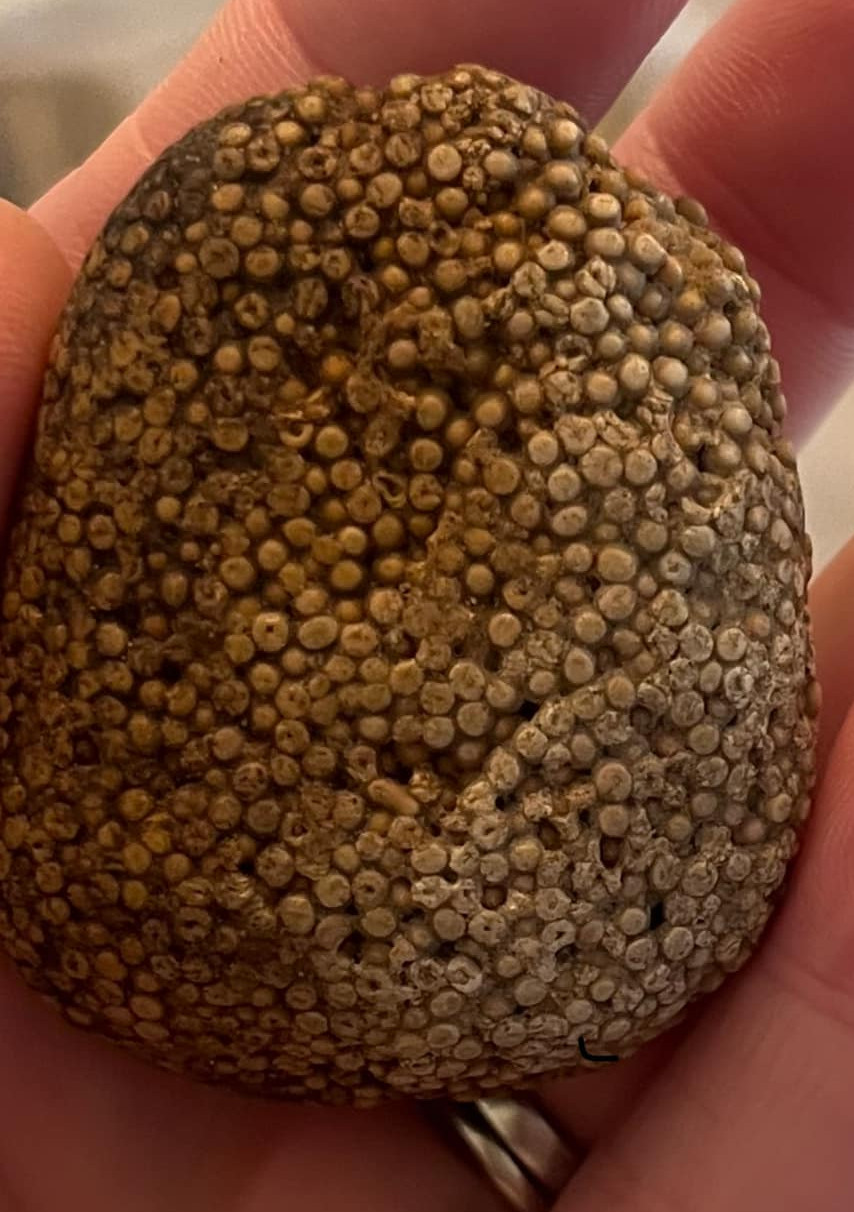
Specimen above collected in Central Mississippi by Josey Cook.
Ok, the fine line between impact and tectonic/volcanic matrix. You have to magnify the picture and look for shock. While tectonic/volcanic events have pressure and shock they are expressed less. This specimen has particles. They are in a developing fractal flow internal to the matrix. Impactite from Kilmichael Structure.

Various impactites from stream in Marion County. These were made by the Jackson Impact Structure.


Impact sphere. This is a liquified drop from a large earth impact. It has chemically altered the more dense core which is a complex mineral form made by the extreme physics. If you magnify it and look at the colors closely you will see, magenta and blue which makes me think the core is a compound of Fe3O4, iron 2 oxide, cobalt and manganese. Or the colors could be iron variants. These elements are common to the universe and the period of large earth impacts. Specimen collected in Tate County, Mississippi USA by: Jacqueline Baker


Dale Tinney Dietrich
Found this on River Bank in Greenville ms
This is a flat impact sphere. The fractal patterns are an energy signature like lightning. The red is a nano iron Fe3O4 trace oxide from the large impacting meteor bolide. The concentric rings are a harmonic effect as shock wave resonance will gather around the center of mass and in this case imprint the wavelength as successive rings.
It also has a mosaic cracking surface on one side.
Of special note is the granular crystal structures shown (constellationing). As an order of physics forms the circle shockwave harmonic will quanta wave degrade into the fractal tree form. The particles from the shock particle storm will form into a common particle which is the matrix. There are many crystal habits of this granular construction but the fractal seen here is an organization from the circle harmonic reforming into the fractal tree form.

Oblate impact spheroid with secondary iron sulfur coating with high heat mosaic cracks. The sulfur reacts with air and also falls apart. While an impactite can be found in any earth strata it is assumed to be relevant. The Eocene Porters Creek Formation is a vague assignment and differs in location depending on source. Not to belabor the point but based on Mars the Earth has over a million surface impact craters of a mile diameter or greater. The geology anomaly maps show the early bombardment period and a crater covering most of the state of Mississippi (see attached from Chegg Products and Services).


SW Mississippi Crater. Just looking at a state can be hard to tell with big multi state craters. But it does go up into MS like an independent somewhat single state impact. Jan. 17, 2024.

Sandstone and a sandstone/chert in a hydrodynamic mixing form. This is from some earth impact as it is a quickly made and quickly solidified specimen. Jan. 19, 2024.
I left it there (Enid Lake, Pope, Mississippi) but took photos. Curious as to what it could be. Pam Potts Hannis ·


Impact sphere and catcher from the Kilmichael Impact Structure. Chert with trace iron. Notice the grove around the central sphere, this indicates a sudden capture as opposed to smooth layering. First picture has iron blast bits from the impacting metero/bolide. It also has a circular impression in the upper right side which was another impalement. While the second picture is not as clear you can see a feathering from the core and back from the edge like splash marks. The edge iron may be impact iron splatter. May 17, 2024.
Donna Roberts Pevey
So is this just a rock with circles on both sides or is there something inside of it? Central Mississippi.

The Uranium "skid marks" are present for this type 2 subduction crater. While not exactly an oval it must have been low angle. Most impacts that make a crater make a round crater. This is because explosions expand in all directions equally. But when an incoming meteorite strikes the ground at a shallow angle — less than 15° above the local horizon — the resulting crater is no longer circular. Low-angle impacts produce craters with an oval outline. Here you can also see it came in from the west. June 19, 2024.

Big crater with crossing fault pattern in OK. The crossing pattern of faults is what you can see in smaller crater that are not buried. It is what you see when a bullet hits glass, radial and vertical cracks. See picture below. July 6, 2024.


Impact blast made conglomerate, red sandstone and chert with fractals showing blast direction from right to left. Unlike most conglomerates the host rock and impalements were clearly made in the same impact event. The insert pebbles are impact spheres. July 7, 2024.
Shamron Anderson
This is a rock I found near the Nanchez Trace Trail in Mississippi about 15 years ago. I have not been able to identify what it is. It does have the appearance of having some included marine fossils.

A couple of interesting differentiations in Mississippi. The first one is up around Iuka. The other is over at the Mississippi River mid state. The heat signatures are from serious impacts that affected the earth's crust. Nov. 11, 2024.